The National Education Nature Park: answering big questions about nature in England

The National Education Nature Park programme sees children and young people transform their outdoor spaces for people and wildlife, all while connecting to nature and developing vital skills for their futures. As well as an education programme, it’s also a huge community science project answering big questions about nature in England.
Community science is a collaborative approach to scientific research that involves data being collected by the public. In the Nature Park’s case, the public are children and young people at schools, nurseries and colleges across England collecting data about their learning sites.
With the UK being one of the most nature-depleted countries in the world, it’s critical we are armed with as much knowledge as possible about land across the country so we can make decisions about how to aid nature recovery.
We know a lot about biodiversity in England, but school grounds remain a bit of a mystery. They cover a huge area yet are the most under-recorded urban habitat type in the UK, meaning we don’t really know what’s living and growing there. This is where the National Education Nature Park programme comes in!
Mapping habitats
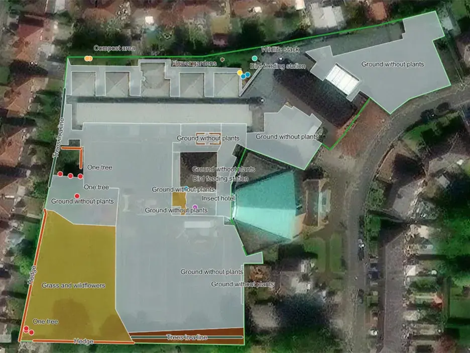
Up and down the country, children and young people are using digital tools to map out the habitats on their learning sites through the Nature Park programme. But why is this important?
As well as helping educators and learners get to know their site better and identify areas that could be improved for nature and people as part of the Nature Park five-step cycle, they also serve as scientific data.
One of the aims of the Nature Park is to boost biodiversity in schools, colleges and nurseries. To achieve this, we first need to understand how much biodiversity exists there to begin with, creating a baseline so we can measure the impact the Nature Park programme is having on wildlife across the country.
Biodiversity is the variety and variability of life—from genes to species to ecosystems—and it can be measured directly, by counting organisms in an area, or indirectly, by mapping habitats in an area and using existing knowledge about species that live in those habitats to estimate biodiversity. Habitat maps of learning sites created by children and young people allow Nature Park scientists to estimate biodiversity at each site and across England’s educational estate.
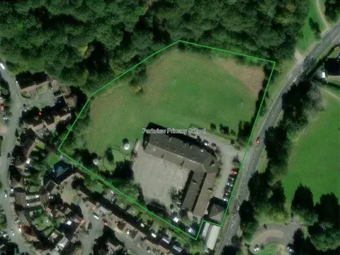
One of the first steps in the Nature Park programme is creating your site boundary – simply using the digital tools to draw a line around the outline of your learning site on a map. Site boundaries can be used to gather information from existing maps and satellite data, addressing scientific questions such as: what is the average vegetation cover of schools, how far are they from nature reserves, what is the density of nearby roads, and the average biodiversity? We can also investigate how these factors correlate with socioeconomic factors of the local area.

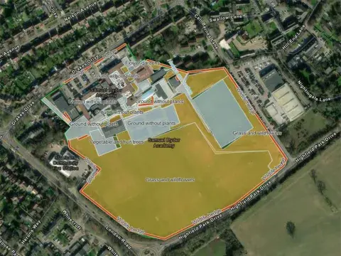
However, site boundaries can only tell us so much. While satellite data can indicate whether a school has areas of grassland or woodland for example, it lacks the detail to differentiate between a playing field and a meadow, or between different types of woodland. This is where the habitat mapping that children and young people are doing through the Nature Park really helps! Surveying and mapping the area gives a higher level of detail. As well as being able to identify different types of habitat in more detail, it also means that habitats that are too small to be detected on satellite images, such as bird boxes or small ponds, can be added to habitat maps of learning sites.

Estimating biodiversity
Once we know the habitats present in schools from the maps created by children and young people, we can use previous biodiversity estimates from similar habitats to estimate biodiversity levels across the schools, nurseries and colleges taking part in the Nature Park programme.
The Nature Park science team get these estimates from datasets such as those in the PREDICTS database, a Natural History Museum led project that holds data on the levels of different species around the world.
This gives us a baseline for measuring change, so that when new habitats, like a pond or a wildflower area, are added or improved through the Nature Park programme, we can estimate the increase in biodiversity expected from these improvements.
Ready to get started?
If you’re ready to get started and be part of the huge team collecting this valuable scientific data, make sure to register for the Nature Park programme here.
Then create your site boundary, and get started with mapping your habitats!
Be sure to get in touch with [email protected] if you have any questions and reach out to your local regional team for support and guidance.