Mapping their site with The Tree Council at St Peter's Catholic College
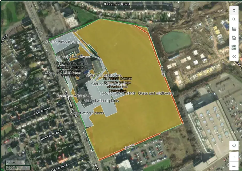
St Peter's Catholic College in Middlesbrough has been getting stuck in with mapping their site. They've been supported by Katie Rafferty, National Schools Programme Manager at The Tree Council, a pilot Nature Park delivery affiliate.
One of the best parts was working with the students to explore parts of the school grounds that they did not necessarily see on a regular basis, for example hedgerows on the far side of the school field. I feel like this also helped students realise how much 'grey' or 'green' surrounds them daily, as this was something that wasn't always acknowledged or even noticed!'"Clare Trainor, Geography Teacher
St Peter's started by zoning the school grounds and assigning responsibility for the different areas to groups of pupils. Framing it as a treasure hunt went down well with students and they were enthusiastic to explore their grounds to see what they could find. Each group was given a paper map of the school grounds to mark the habitats on ,and then back in the classroom it was uploaded on the desktop version of the habitat mapping tool. This was a great way to involve the whole class even without access to iPads or tablets!
Working with Katie from the Tree Council was really fun. We used the mapping software to plot the different environments at our school. It was really useful and made me realise how much green there was near our school that we just take for granted. Sometimes we forget it's even there".
Year 9 pupil
Linking it to careers
St Peter’s found that linking habitat mapping to future careers, such as job roles that use GIS technology, helped pupils to understand the importance of the activity. St Peter’s are excited to use more GIS in their geographical skill section of the curriculum going forward.
This isn't just something we're doing now because it's part of the Nature Park. This is a skill that is helpful in life".
Katie, The Tree Council
Top tips for habitat mapping from St Peter's
Before you get started, have a session to practice using the Habitat Mapper tool
Use a satellite map of a familiar local area to practice using the software
Emphasise the real-world application of this activity to engage students even further
