Mapping your site: three ways schools have done it
Whether your site is buzzing with life or is perhaps a little greyer than you’d like, mapping your site is the essential first step in your Nature Park journey that helps you understand your starting point and sets you up for curriculum teaching for years to come.
Mapping your site is a one-off activity that guides you and your students through creating a detailed baseline map of the habitats on your school site, from playgrounds and grass to trees and flowerbeds. By creating this foundation for your Nature Park journey, you’re able to track and measure the impact you are having, starting to build a bank of real-world data from your site to aid your curriculum teaching, and taking part in hugely important research with scientists at the Natural History Museum!
We spoke to three schools who have been completing their habitat maps about how they’ve run habitat mapping sessions, what they’ve got out of it, and their plans for the future.


Mapping habitats within the outdoor curriculum at Larkholme Primary School
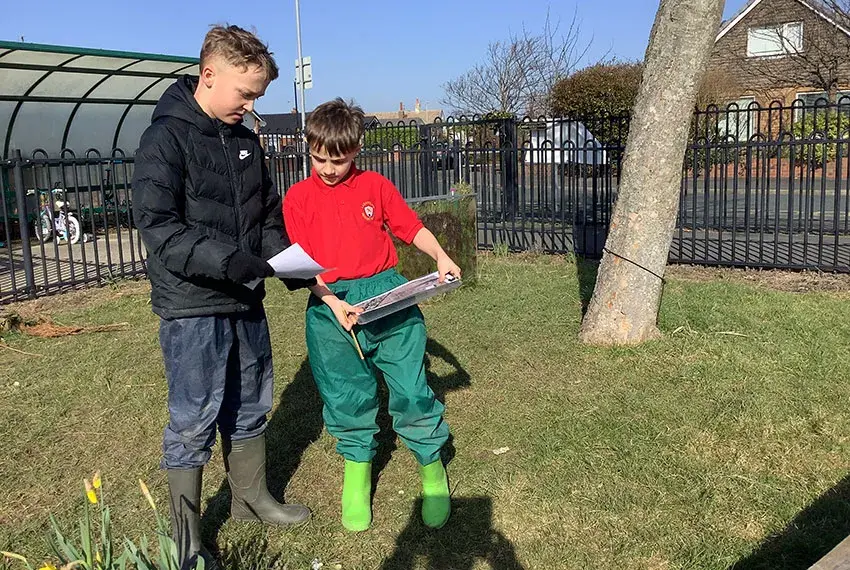
Larkholme Primary School in Lancashire have a strong outdoor curriculum which they've established over the last five years. They've been bringing in Nature Park resources and activities – including habitat mapping – into their outdoor lessons. At the time of writing, Larkholme have mapped three habitat types so far. With three classes in Year 5 and 6 they've been able to take on one each – discussing it together with the teacher before going off and doing it quite independently.
"The mapping your site resources fit really well with our map skills topic, and the children really enjoy doing it because it's so pertinent to them – it's our grounds. We can ask questions like what have we got, what would we like more of, and what can we see? They also love the fact they are part of a big research project!" Rebecca Sims, Outdoor Learning Coordinator
Read more

A whole-school approach at Colneis Junior School
Colneis Junior School in Suffolk are taking a whole-school approach to the Nature Park, involving all pupils and staff in the process. During the spring and summer terms, all year groups were involved in outdoor learning sessions which contributed towards mapping the site, ensuring that all of the 345 pupils feel involved and that their contribution matters. They've done this through the mapping activities by dividing their grounds into different areas, with each class or group being responsible for one part and then combining the data collected.
Read more

Mapping their site with The Tree Council at St Peter’s Catholic College
St Peter's Catholic College in Middlesbrough have been supported by The Tree Council, a pilot Nature Park delivery affiliate. St Peter's started by zoning the school grounds and assigning responsibility for the different areas to groups of pupils. Framing it as a treasure hunt went down well with students and they were enthusiastic to explore their grounds to see what they could find.